by Kevin Neill, Planner at Alta Planning + Design
Wayfinding signs are not just for tourists and visitors to your city, although the metaphor is a good one. Think back to the last time you were on vacation, traveling through a city for the first time. Everything was foreign — the streets, the buildings, even the rhythm of daily life. Even with the map you pulled up on your phone, or the chicken scratch directions you jotted down before you left home, your senses were on high alert. You were always on the hunt for information to lead you forward, point you in the right direction, and confirm you’re on the right path. You relied on signs, landmarks, and other visual cues to lead the way.
For many us, taking to the streets on our bikes for the first time can feel a lot like traveling in a new city. Our route choices as bicyclists are often different than our route choices as drivers or transit riders. We go out of our way to explore new streets, hop on a trail, ride on the street with separated bike lanes, or cruise on the quiet streets and signed routes to get to where we want to go. Instead of the quickest path from A to B, we combine comfort and quality with directness and efficiency to create the perfect ride. Different visual cues help orient us and create a new mental map of the community, like shared lane markings, bicycle lane striping, and wayfinding signs.
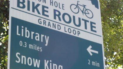
Some of the most common visual cues we use to get around are the standard green bike route signs:

These go-to wayfinding signs come in a few varieties, all defined and codified in the Manual on Uniform Traffic Control Devices (MUTCD). Bicycle facility design has been evolving at a rapid pace (check out NACTO’s guide to wayfinding signage), but national wayfinding design standards and guidance have remained relatively static over the years. That doesn’t mean there’s a lack of innovation, though! Cities and counties across the country are constantly experimenting with new designs and ideas that may have big implications for the future of wayfinding:


One of these cities is Columbia, Missouri.
With a large student population and a culture that supports and values outdoor recreation, bicycling is a popular activity for Columbia residents and Mizzou students alike.
The City was just one of four communities awarded funding through the Non-Motorized Transportation Pilot Program in order to develop innovative programs and infrastructure to increase walking and bicycling rates (along with Marin County, CA, Minneapolis Area, MN, and Sheboygan, WI).
In 2014, the City of Columbia, with support from the University of Missouri and Alta Planning + Design, submitted a request to the Federal Highway Administration to test the efficacy of a variety of innovative bicycle wayfinding pavement markings. The City has developed this idea for wayfinding pavement markings as a means of reducing sign clutter and increasing wayfinding indicator visibility for cyclists, who are often looking at the ground ahead for positioning, hazards, etc.
Engineering faculty and staff at the University of Missouri have built, from the ground up, a bicycle simulator to test these markings.


The simulator will test subjects as they pedal through a virtual city and follow a hypothetical bicycle network using these experimental facilities. Staff from Alta and the City of Columbia stopped by to take the stationary bike simulator on a test ride through the virtual city in early August. While the model still has a few tweaks before official testing begins, the simulator has vast potential for bicycle facility innovation.